 2023 John Beavan Geodetic Fieldwork Award:
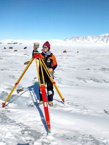
Holly Still
Holly is planning to install a network of GNSS units on the McMurdo Ice Shelf of Antarctica to measure its velocity and deformation.
The novelty of this work is the use and testing of low-cost GNSS stations that not only cost less but consume less power than survey-grade GPS, potentially enabling them to provide continuous measurements over winter.
Past John Beavan Geodetic Fieldwork Award winners
| Year | Person | From | For |
| 2018 | Emma Cody | Massey University | Quantifying slope response to glacial retreat in the Aoraki/Mt Cook National Park with emphasis on the mechanics, processes and risks posed by these failure events. |
| 2017 | Not awarded | ||
| 2016 | Robert Pickle | University of Auckland | Geodetic surveys in the upper North Island to investigate active deformation of the Hauraki Rift. |
| 2015 | Sam Taylor-Oford | Victoria University of Wellington | Temporal, spatial, and seismic response of the Tasman Glacier to changing basal water pressure. |
John Beavan

John Beavan was a brilliant scientist with a prodigious appetite for work whose contributions to the understanding of plate tectonics and earthquake science will form a long-lasting legacy.
John gained a PhD in Geodesy and Geophysics from the University of Cambridge, where he discovered he could combine his two favourite things – being in wild and remote places and physics – by working in Earth sciences.
After finishing his PhD, he spent 18 years at Lamont Doherty Earth Observatory at Columbia University in New York.
A turning point in John’s career occurred in 1980 when scientists realised they could use the new military GPS system for high-precision measurements of land deformation. As an early adopter of this technique, John soon became one of the leading scientists in the world at measuring tectonic deformation with GPS.
On moving to New Zealand in 1994, he immediately dedicated himself to building a world-class GPS network to investigate plate boundary movements here.
In 2001 the network of GPS instruments that John had help to build enabled the discovery of slow-slip earthquake events under the east coast of the North Island. As a result of his GPS work in the South Island, he was the first person to discover that the Southern Alps were increasing in height by between 6-10 mm each year due to tectonic forces pushing from below.
Throughout his career, John was regarded as a vibrant colleague and wonderful companion during field campaigns.
The John Beavan Geodetic Fieldwork Fund was set up by the GSNZ in 2014 as a memorial to Dr John Beavan.